

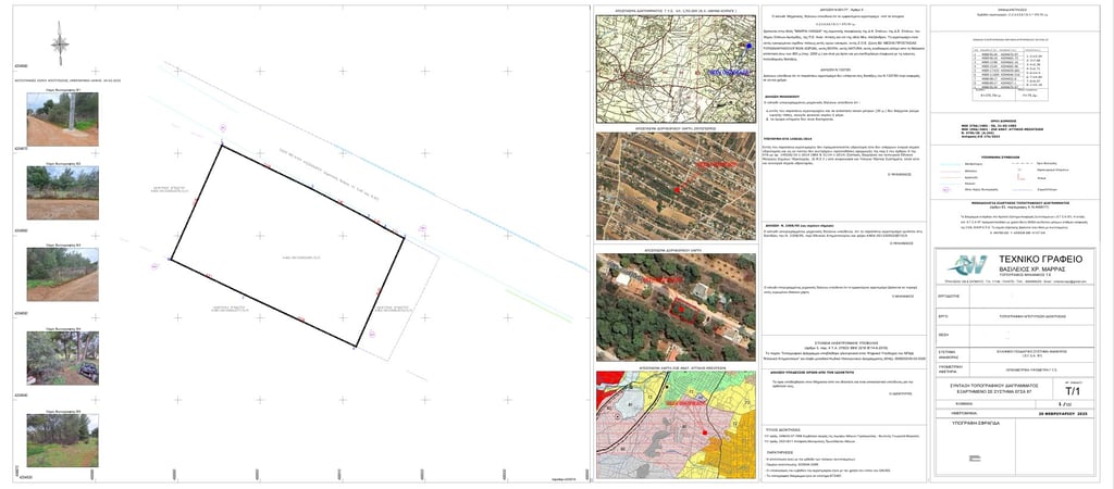
Topographic Surveys Outside City Plan
Topographic diagrams for properties outside urban plans represent a highly demanding process, as they cover properties in areas that are not part of the urban fabric and may include large plots or properties with unique characteristics. Preparing a topographic diagram for an off-plan area requires specialized knowledge, as these areas are governed by specific building and utilization regulations.
With our extensive experience in surveying and geoinformatics, we undertake the creation of topographic diagrams for properties outside urban plans, offering accuracy and reliability in every project. The diagram includes the mapping of property boundaries, elevation differences, access roads, as well as the presence of any streams or other natural features that may impact construction.
Topographic diagrams for off-plan areas are essential for issuing building permits, land subdivision, as well as property transfers or other legal actions. An important aspect of the process is the precise mapping of building terms and the relevant restrictions governing the area.
We guarantee the completeness and accuracy of each topographic diagram, utilizing the latest technological tools. Through proper mapping and our expertise, we ensure the property’s compliance with regulations, avoiding legal issues and delays.


Topographic Surveys Outside City Plan
Sample of Topographic Diagram within Urban Plan
Contact Form
Home
About Us
Contact
Useful Links
Adress
Tralleon 136, Galatsi 111 46
Phone Number
+30 694 590 6300